B&B Holidays on the Isle of Wight

Your comprehensive guide to enjoying England's charming island through authentic bed and breakfast experiences

Isle of Wight Walking Maps

Discover the Isle of Wight on foot with our detailed walking maps and guides.

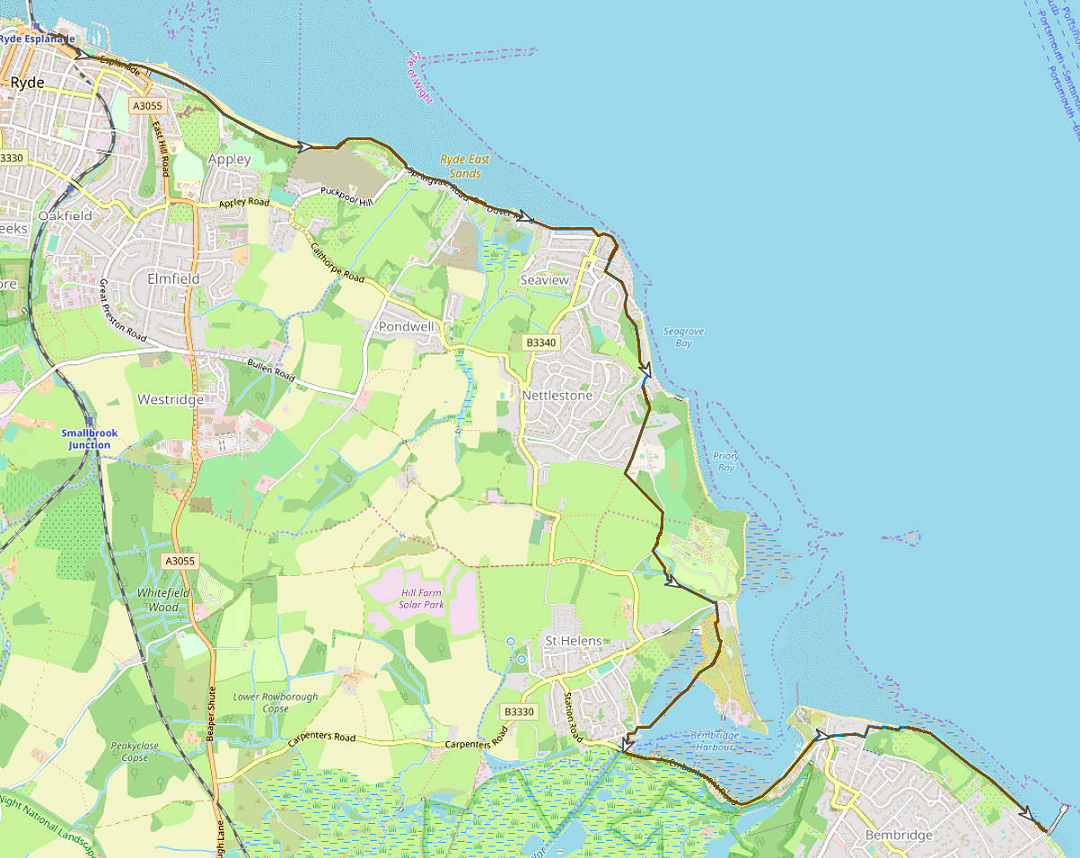
Ryde to Bembridge via Brading Marshes

6 miles (10km) - 2.5 hours - Easy difficulty

Map of the Yar Estuary Walk route

Walk Steps

  1. Begin your walk at Ryde Esplanade (near the train and bus station). Walk east along the A3055 Esplanade, passing the boating and canoe lakes. Continue until you reach Appley Tower on the coast.
  2. Just beyond Appley Tower, take the signed coastal path that runs through Puckpool Park. This is part of the Isle of Wight Coastal Path and is well signposted.
  3. Leave the park and continue on the coastal path through Seaview. You’ll pass along Duver Road briefly, before joining Footpath R86, which cuts inland across open fields.
  4. Follow Footpath R86 as it merges into Footpath B1, leading you toward Brading Marshes. At this point, you’ll join the National Cycle Route 23 briefly as it heads into the RSPB reserve.
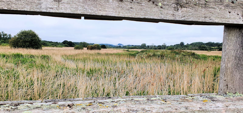
  5. Continue through the peaceful Brading Marshes RSPB Reserve along Footpath B5, with views of wetlands and birdlife all around. The path takes you east, skirting the base of Bembridge Down.
  6. Exit the marshes near Quay Lane (B3395) and follow signs along Footpath B61, which takes you toward the heart of Bembridge village. You'll pass through quiet countryside before arriving near the village shops and cafés.

About Brading Marshes Isle of Wight

Isle of Wight Brading Marshes

Brading Marshes

Brading Marshes an RSPB reserve and one of the island’s most important wetland habitats. Nestled between the towns of Brading and Bembridge, this peaceful area is a patchwork of reedbeds, wet meadows, ditches, and lagoons. It provides a rich and varied home for a wide range of wildlife, especially bird species. Visitors often spot herons, egrets, marsh harriers, and warblers, with migratory birds passing through during spring and autumn.

The reserve is crisscrossed by a network of public footpaths and bridleways, including parts of the Bembridge Trail and several National Cycle Network routes, making it an ideal spot for walking, cycling, and birdwatching. Interpretation boards help visitors understand the area’s ecology, and the flat terrain makes it accessible for all ages and abilities.

Brading Marshes is also a site of historic interest. Once part of a tidal estuary, the area was drained in the 19th century for agriculture, though today it is managed to support both farming and conservation. The marshes are bordered by Bembridge Windmill and the striking Bembridge Down, adding scenic value to any visit.

This serene reserve offers a quiet, immersive experience of the Isle of Wight’s natural beauty, just a short walk from surrounding villages.

Isle of Wight Brading Marsh